Tackless II's Home Page & Website
Women & Cruising Website
Jimmy Cornell's Noonsite
Seven Seas Cruising Association
Fiji's Weather Site Victoria University's S. Pacific Weather Site Fijian History Palmlea Lodge and Bures Nukubati Resort Musket Cove Vuda Point Marina First Landing Resort About Vanuatu About New Caledonia
10 March 2009 -- What the 2Cs Have Been Doing wit...
New Australia Blog
28 October – 6 November, 2008 – the Port2Port in B...
27 October 2008 - Day 7 on the Road to Oz
26 October 2008 - Day 6 on the Road to Oz
25 October 2008 - Day 5 on the Road to Oz
24 October- Day 4 on the BUMPY road to Oz
23 October 2008 - Day 3 on the Road to Oz
22 October 2008 - Day 2 on the road to Oz
I'm sure you've noticed that I haven't yet done an update on our time in Noumea. Well...it didn't get done. But we had a good time, and it will get written up. However, this morning we are weighing anchor and getting underway for Australia. it is not an ideal forecast, but mostly it errs on lighter winds than heavy, but for one day with headwinds and big swell from the southern ocean. That will be obnoxious, but in trade we get nice weather for our departure and our arrival, which seems the more important. So, off we go. I will try to make daily postings of our progress.
Love to all -- Don & Gwen , the Two Captains
This e-mail was delivered via satellite phone using GMN's XGate software.
Please be kind and keep your replies short.
Labels: New Caledonia
Baie de Prony is named for the vessel that first explored it in 1854. Only ten years later a "forestry industry" began here using convict labor. (New Caledonia was, like Australia, initially a penal colony.) Throughout the bay are sprinkled ruins of convict "settlements," but there are no remains of the forest. I've been told that the original forest cover was the huge, slow-growing kauri pine that was popular in shipbuilding. Not sure if this is correct. It is hard to imagine. There is none of it remaining, and no evidence of replanting. The hills as far as you can see are red earth, thinly covered by green scrub with great orange gashes of landslides and erosion. It is sad but oddly beautiful.
We were surprised that Procyon would take the very first anchorage because Baie de Prony has no fewer than 16 identified anchorages within it, six of which alone are in the large eastern interior bay called Bonne Anse. Anchorage "A", as it is dubbed in the cruising guide, is right out behind the wooded point that merges with Prony Reef and is only protected from southeasterly winds, which, granted, are the predominant winds in the region. Well, it proved to be an outstanding choice, because the wide open view to the west – over Prony Reef to Île Ouen and the Woodin Channel -- then north to the multicolored hills backing the western side of the Baie de Prony -- was simply awesome, morning, midday, evening and even by moonlight!
PROCYON REUNION
Randy and Sheri had, unfortunately, been forced to spend nearly a month in Noumea after Randy had a mishap learning to kite-board and rammed a piece of coral well up into his foot. This became quite infected and ended up needing surgery, and his back compounded his misery by going into spasms. He was not a happy camper for a few weeks. However, he had as good an experience with the French medical system in Noumea as we had in Raiatea, and, in the end, Noumea is not a bad place to recuperate with its delightful market right at the head of the marina. The good news for us is that the Procyons would otherwise have already been on their way to Australia, and now they will be making that trip the same time as we.
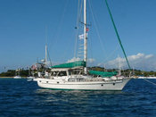
We had a lovely afternoon and evening visiting aboard Procyon, which is a custom-built Gozzard 44, a truly beautiful boat with an owner's open layout placing a spacious dining/living area in the triangular space where usually there would be a forepeak cabin. We did steaks and baked potatoes on the grill, and relished a green salad with fresh ingredients and talked boat talk around their lovely dining table. It was a fleeting reunion, though as early the following the morning, they were underway south to the Isle of Pines. We, however, were left with the gorgeous view to ourselves.
BONNE ANSE
We lingered there a day working on various projects, then the next morning raised anchor to poke around the other five anchorages in Bonne Anse. One of the reasons Randy and Sheri has stopped so quickly is that they had seen a number of boats precede them in this direction. Over the course of the following day, we'd watched most of them leave again, so when we motored east ourselves, we were pleased to see that all but one boat had departed. We chose anchorage "E" on the north side of the bay in which to put the hook down as the forecast was calling for the wind to clock around to the north. Anchorage "E" was a cove of eroded orange hills laced with green, a red sand beach backed by a grove of green trees, and a wide semi-circle of shoals completely sedimented in red silt. Grandterre's red and green color scheme, so eyecatching at a distance, is rather intense up close, and in anchorage "E" we had totally sacrificed the long view. It was, however, quite a bit warmer, a function, I think, of both the wind shift to the north and the encircling land mass. Plus, again, we were totally alone…that is, except for the flies.
We had heard mention of the fly problem on the radio but had not imagined its degree. We paid the price for being late getting our screens up as the interior of the boat was beseiged. We are talking hundreds. The flyswatter was excavated and put to constant use. There is one redeeming feature of flies; they go to sleep at night, so you can. Okay, and they don't bite. But, Jiminy Christmas they are IRRITATING!
Our second morning in Anchorage "E", we dinghied across the bay to a trailhead leading to the lighthouse atop Cap Ndoua. This is the very important leading light for the Havanna Passage, the main ship entry from the east. We secured the dinghy off a nice little red sand beach and easily found the trail. Once upon a time, this trail was a road, but erosion has carved deep gullies in the bed, and recent rains or perhaps just the morning dew made the hard-packed clay very slick. We emerged from the tunnel of trees about half-way up and climbed the rest of the way to the light flanked by hip-high brush but with awesome views in every direction. What's really amazing about this panorama is that there is hardly any sign of man in it, discounting the light itself and its associated equipment, some ruins on a lower plateau, and a couple of red earth roads winding off to the east. That the hike is a popular one is attested to by a "flagpole" where hikers have hung items of clothing (including a pair of bikini panties) as well as a curious form of natural graffiti: the entire vale just east of the light is filled with "signatures" shaped from assembled rocks and then framed in a rectangle of rocks. I suggested we put together a "Tackless II was here" or "The Two Captains were here", but Don pointed out that either would take a lot of rocks.
But here's a peculiar thing. No flies on shore!
The illusion of "little sign of man" proved to be just that: An illusion. As we motored out of Bonne Anse that afternoon to check out some of the anchorages on Prony's western side, a huge industrial complex was revealed filling up the whole eastern part of the bay! Just over the ridge from where we'd been anchored! Now we know that the great lume of light we'd been seeing in the sky since Port Boisé is not Noumea at all, but this plant! The cruising guide describes a rock crushing facility here, which it claims closed in 1968. Whatever this is, it is neither defunct nor old!
Once revealed, it tuned out to be pretty hard to shake the specter of that monstrosity. We motored behind a little resort island called Ilot Casy up into the western arm of the bay, but still bits of the factory kept sticking up above the landmasses we tried to put between us and it. We were intending to go all the way up the bay to its fjord-like end, an area known as Carenage, with two hurricane-hole anchorages and some hot springs. But Don's interest was waning fast, so we turned instead towards a cove called Anse Sebert. Imagine our surprise when we rounded the point and found not just four other boats (one of them our buddies on Avior), but moorings!
ANSE SEBERT
We aren't sure who put these moorings here, but there are about ten of them. The chart shows a village nearby, but Jim and Paula of Avior did a walk ashore and found only ruins amongst which there appeared to be holiday "shacks." So perhaps they are the work of a Noumea-based cruising club. However, the landing was not in the possession of vacationers today, but a squadron of military types with a small fleet of inflatables. Over the course of the afternoon, a helicopter landed, took off, circled and landed over and over, and guys with rifles hid behind trees and tried to look inconspicuous, ignoring Jim and Paula as they took their walk! Later, while the four of us relaxed and pondered the situation over some cocktails, eight inflatables with eight men in each paddled off into the night. That it was a training maneuver and not a guerrilla takeover was suggested by lead and tail-gunner dinghies sporting engines and running lights!
RECIF DE L'AIGUILLE
The big attraction in Anse Sebert for non-military types is the nearby dive site Recif de L'Aiguille (Needle Reef), a rock spire that ascends nearly to the surface from about 80 feet right in the middle of the channel. Our dive gear, all nicely serviced in Fiji, has been sitting largely unused this season, and quite honestly, if it hadn't been for Paula's determination, it might still be packed away. The hesitation (besides pure laziness) has been the water temp. Readings have hovered at about 74-75 degrees on the surface which suggests colder temps below. This is about three degrees colder than the winter temp in the Virgin Islands, and up until the last few days, air temps have been pretty chilly, too. Have I mentioned that Don and I foolishly took our heavier wetsuits back to Florida? Well, we hadn't needed them since Mexico! But, at 0830 the next morning, after seeing Avior's gear start to emerge, we decided we wouldn't be wimps and started excavating and donning every bit of gear we still have. For us that meant Lycra suits topped by Polartec suits and hoods, booties and gloves. I was lucky to also have a neoprene chicken vest to add to my get-up.
It was, in short, a great dive! From about 60 feet up to about eight feet below the surface, the spire is encrusted with corals, sponges and a crazy variety of shellfish. Visibility was good and the sunlight just right to highlight some unusual formations. Huge groupers, that folks in these parts call cod, poked up from the depths to check us out, a pair of huge batfish kept shyly just ahead of us, while lovely pale spotted hinds (which folks in these parts call grouper or coral trout) tried to camouflage themselves against pale coral "stalagmites." According to the cruising guide, fresh water comes out the tops of these unusual formations, which must be how these reverse concretions have accumulated! In fact, it is probably how the how structure came to be, a fresh water leak in the seafloor depositing its minerals in a climbing tower eventually aided by reef building corals. Tiny little bi-color damsels darted hither and thither, while bigger "tropicals" wove around us. Presumably because this is a preserve, the fish were not particularly fearful. (That's, of course, because they didn't know what Don was thinking; he did a lot of "finger-shooting"!) We all surfaced delighted and wondering what we'd been waiting for!
APRES DIVE
By evening the weather had turned gray and rainy, but several of us were invited aboard the catamaran Lady Nada for an impromptu cocktail party. Lady Nada and Heat Wave were the hosts, and Avior and Tackless II the guests. Lady Nada is a big catamaran single-handed by its builder David, and Heat Wave is a fast monohull skippered by an attractive German woman, Bridgit and her partner in the boat Lee. All of us had been on the ICA Rally from Vanuatu, but we'd not gotten to know the others (other than Avior) very well. It was quite the international evening with a South African (David), Englishman (Lee), German (Bridgit), Scot (Paula), Aussie, Jim and we two Americans. Sadly, no one had invited the one French boat that came in..
HIKING ASHORE
On Friday, the weather stayed overcast and grew blustery, evaporating any enthusiasm to revisit the dive site. Instead, the group began to disperse leaving only Tackless and the French boat in the anchorage. In the afternoon, we grew antsy enough to dinghy to shore to check out, now that the military had vacated, the walks that Jim and Paula had found. After securing the dinghy to a nice floating dock, we found a detailed map of 14 kilometers of trails through the Prony preserve area! Wow! We could have walked up to the Carenage anchorage! One sure could spend some time here! Unfortunately, we only had a few hours until sunset, but we set out to the north along the shoreline following a well marked path around the headland to Prony Village.
At an intersection in the middle of the woods we stumbling upon a display answering some of the questions we'd had about the forest industry here. According to the display, Prony village was established in 1865 to house convict labor set to the task of felling the native big kauri pines and gum oaks. Right on a section of the trail was built an example of the wooden rail system that had been used in those days to move the huge logs. Smooth log rails were laid across wooden ties on which were mounted big wooden sleds, maybe thirty feet long. On these were secured an entire tree trunk. Even with this fairly slick system, there must have been a lot of back-breaking labor for the convicts, not the least of which was getting the log onto the sled. On the hill above this display was the convict cemetery lost in second growth woods, where, if a sign didn't tell you there were graves there, nothing else would suggest it. Further along the path were stone-wall ruins of the penitentiary, now incorporated into what do appear to be weekend cottages. Around them, several freestanding stone walls, even one entire building, had been totally encapsulated by the roots of banyan trees! The cottages were planted artfully with flowering shrubs, and everything looked like a landscaped park. Whatever one may say about the French colonial system, one has to be impressed with the infrastructure. Not just the roads and utility poles that impressed us in the Loyalties, but the details of these parks, the well-groomed trails and signposts, the first class docks and wharves. It is so noticeable, of course, because we are talking first world management in a third-world situation.
GONE ASTRAY
On our way back to the dock, Don noticed that there was another marker on the fringing reef just like the one we had all tied to when diving on Recife de l'Aiguille. On second look we realized, it WAS the marker we had tied to! Somehow, within the preceding few hours, it had broken free and drifted to shore! This is not good, considering the reef comes to within a few feet of the surface! It also would not have been cool to have been down on the dive when it came loose! (Of course, we were diving in calm conditions, and it was currently blowing about 20 knots.) On our way back to the boat, we stopped to introduce ourselves to and chat with the French couple of Fidelio (turns out they are physicians who have lived aboard 30 years and worked in Martinique, Nuku Hiva, and Noumea.) Just as we were suggesting that they – with their better French - call Noumea Radio to report the displaced "balise", up zooms a Marine Patrol boat, and within minutes it was on the notice to mariners!
As we climbed back aboard Tackless II we were of mixed emotions about whether to go or stay longer. It would have been nice to explore more of the trails. Indeed it would have been nice to spend several more weeks checking out all the rest of Prony's anchorages. But with Noumea still waiting and the month ticking down fast, we opted in the end to move on.
By the way, I forgot to mention that when we went to shore for the hike, I sprayed the beejezus out of the interior of the boat with bug spray meant for mosquitoes that we'd filched from our Fiji hotel room. By the time we got back, the fly problem was history! Now, keep those screens closed!
This e-mail was delivered via satellite phone using GMN's XGate software.
Please be kind and keep your replies short.
Labels: Diving, Hiking, New Caledonia
It is up close that the island reveals its charms with picturesque anchorages fringed by powdery white sand beaches and whispering araucaria pines. These pines, related to Norfolk pines, grow tall and slim, usually in clumps Oddly, all the pines near where we anchored sport ten to fifteen feet of new growth at the top, making them look like Christmas trees have been grafted to their tips. Some environmental event in the recent past – drought or hurricane perhaps – must be responsible.
As we sailed south from Grand Terre, we hooked up with our friends Tricky and Jane of Lionheart, last seen over a month ago kite-surfing at Musket Cove. They had chosen to skip Vanuatu this season and hurry on to New Caledonia where there was said to be good locations for their new passion. Much of this past month, they have spent around Noumea where Maitre Island is a kiting mecca. It was our good fortune that they had decided to head south to the Isle of Pines at the same time as we, and that we had both chosen the southern anchorage group.
Upon arrival, the main anchorage of Kuto had a bunch of boats already at anchor, so we decided to try the smaller, but empty Kanumera anchorage, on the opposite side of the same "presque'ile", (a lovely French word for "almost island) for which we were lucky to have the right wind conditions for one night. Lionheart dropped anchor in the western lobe of the bay while we tucked into the eastern lobe. This was a lovely pool defined by massive limestone knobs at the entrance and a perfect curve of white sand. There was, of course, an upscale gite in the corner, with tourists taking the sun in lounge chairs and others paddling around in kayaks. So we did sort of feel like we'd anchored dead in the middle of the resort's swimming pool.
We, of course, could have sat there and enjoyed the scenery all afternoon, but Tricky and Jane saved us from such idleness by collecting us for a walk to the bakery. The walk to the bakery took us across the isthmus between Kanumera and Kuto, with a memorable grove of bugny trees (rather like live oaks with twisted trunks and an interwoven canopy), along the huge beach at Kuto, and then inland along a paved road. Our first stop was little store with basic groceries and, of all things, a Croc boutique! This in a region where Croc copies at half to a quarter the price of originals clad probably 50% of the feet! But they had every Croc style imaginable. After ice cream from the store, the boys lost interest in the walk, so Jane and I padded on another kilometer or so to eventually find the bakery, where…. there was only two baguettes left! Finding a bakery for fresh baguettes is a popular endeavor in French islands, although trying to figure out when you can actually get a loaf other than from 5-7am can be challenging.
The next morning we all went ashore early and met up with our Aussie friends Jim and Paula of Avior for a hike up Pic N'Ga. The trail up starts out shaded, but soon opens out into low scrub and red rubble so reminiscent of hiking in the Sea of Cortez it was eerie. About an hour each way, the top affords a nearly 360-degree panorama of the island and its reefs. Hot and footsore afterwards, we stopped back at the beachside "Snack" (French for affordable place to get anything to eat), for our first Number One beers and a "Sandwich Americain", which is the baguette version of a hamburger and fries rolled into one. How is it the French tend to be slim with all the bread they eat!?! Although a nap would have been my Number One choice for the afternoon, a forecast wind shift suggested we'd best move around to Kuto before nightfall, which we did. Our reward was to find that Kuto is an anchorage full of turtles, something we really haven't enjoyed since the Virgin Islands, plus it is a fine place for a green flash.
The next morning we were up early and on the road by 0630 hoofing it to the village of Vao where there was said to be a Wednesday morning market. We caught a ride in the back of a pick up truck the last few kilometers to find that most everybody at the market were fellow cruisers. The market was very small, but the ladies present did have some lettuce, cabbage, green beans, christophene, carrots and papaya as well as some "market eats". This kind of grazing is one of Don's favorite activities. Here he could choose from sweet crepes to chowmein filled roll-ups, from pineapple cake to some sort of fried banana fritter. Vao is a pretty village with a beautiful church, framed by two schools on either side. The little ones about Kai's age were all assembling for the day as we walked past. It was surprising how westernized they seemed, with their cute little outfits and knapsacks. There was even one youngster peddling to school on his little bicycle with training wheels (much like Kai's Elmo bike), with Dad bringing up the rear (and providing the bulk of the propulsion.) To counter the market snacks, we walked the whole the 6K back. Somewhat pumped by the walk and wired by several cups of caffeinated coffee (we usually drink decaf), we fell to boat projects in the afternoon and got a lot done. The day actually ended with some dancing in the cockpit to our wedding CDs.
That forecast wind shift came through with a vengeance bringing brisk winds from the south. In this part of the world, southerly wind means cold, and we had trouble keeping warm the next couple of days. The plan was to rent a car with Avior on Thursday, but the morning kind of expired without managing to get the car rented. In the end, we lined it up for Friday, which meant we could start by hitting the Vao market again. This time, little lettuce but avocados and fresh herbs!
After depositing our groceries back at the boat, the four of us set off with Don at the wheel (since Jim and Paula figured he'd be better at the left hand drive/driving on the right thing!) The morning was overcast, which was disappointing, and I wondered as we set out clockwise around the island, taking all the turns for each of the bays, if a car for a full day would be a waste of money. After all, it is not so large an island. Our first couple of stops, two of which over-looked the alternative anchorages of Ouameo and Gadji, were underwhelming without sunlight. In the latter at least were several masts poking up from behind an offshore islet.
Things got better when we turned down the access road for the Grotte de La Reine Hortense (Cave of Queen Hortense.) To begin with, it was the first time we had a sense of the Kanak tribes still living here (there are eight clans dividing the island who manage to live relatively traditionally among the tourists), as we passed a field where men and women were cooperatively hoeing a potato field. At the cave itself, was a booth for collecting a 200cpf admission per person…on the honor system, although a lady magically appeared when we needed to make change. (I must make note that this nice lady was the first New Caledonian, Kanak or French, to be overtly friendly!)
What a lovely spot! This is a "don't miss" for anyone visiting Ile du Pins. Set in a cool canyon of forest, the caretakers have planted what essentially is a mini botanical garden. (Of particular interest to me were the very tall trees, which Jim identified as iliocarpus (sp), a tree species I planted in Crystal River! Mine was pruned to look like a Christmas tree. Who knew!) The cave itself is huge! A cavernous maw with a stream meandering into it, the cave penetrates back far enough for it to get quite dark until you reach the far end lit by a gap in the roof. All sorts of stalactites hang from the roof, some growing at an angle as if drawn by the light! At the end is a platform of rock said to be the Queen's bed when she reputedly hid here during tribal wars in the 1850s.
When we were finished taking pictures of ourselves standing in front of various stalactites, we drove on to the Baie d'Oro. Here, on an islet of its own, is the five-star Meridien Hotel. We got no further than the front gate which is atmospherically on the far side of a bridge over a moat-like salt water inlet beset by pine trees. We could have gone on, if we'd been of a mind to pay $60pp for lunch! Instead we found our way to the charming little Gite Chez St. Regis, which perches on the other side of the saltwater moat. Here we had a local beer and tasty omelets with fines herbes and lardons (the French's less charming word for fatty bacon). What we didn't know we could have had, had we ordered ahead, was a chicken/fish/lobster bougna, a local delicacy cooked in coconut milk in a big round packet of banana leaves. That's what most of the tourists who filled in after us had.
The big draw in this part of the island (for those not staying at the Meridien) is the "piscine naturelle", a beautiful natural swimming pool of bright shallow sand occurring between three rocky islands. We walked from Chez Regis across the "moat" and along a trail leading to the piscine with every intent (at least by Paula) to go swimming. But although the clouds had cleared during lunch and the "piscine" was every bit as inviting as advertised, it was just too cold in that southern wind for cruisers to peel off and get wet. Only the dozen or so young Asian tourists (Paula talked to a couple who were Korean) were actually getting in the water!
On our walk back occurred a small mishap. Following the path with my eyes on my feet, I managed to walk full bore into a low tree limb. I cannot even claim the excuse of wearing a ball cap. The result is a charming scabby scrape dead center between my eyes as well as, at the time, a headache. Although this somewhat dimmed my pleasure in the rest of the afternoon, it did not stop us from a 40 minute hike through the woods to see the Baie de Upi, a huge, totally enclosed lagoon filling up the whole southwest corner of the island. Reaching it, however, was anticlimactic as it smelled rather distinctly sewer-like!
Our last stop of the day was the Baie de St. Joseph, just off Vao again, where they are famous for large traditional sailing canoes on which the locals take tourists for rides. The daysails were well over for the day, but as yachties we were interested to see the huge dugouts up close.
We relaxed in the Kuto anchorage one more day, visiting with Tricky and Jane some more, as well as meeting their friends Paul and Glor, who just bashed their way here from Australia on their brand new Fontaine Pajot catamaran. The weather stayed chilly, and clouds brought occasional showers. When we woke early Sunday morning after a night of rain, it did not look especially optimistic for our planned departure, but by golly we were underway by 0600 and by 0800 the skies had cleared and we were enjoying a fine fine reach north, bound for the Baie de Prony.
This e-mail was delivered via satellite phone using GMN's XGate software.
Please be kind and keep your replies short.
Labels: Hiking, New Caledonia
In Port Boisé there's a new-ish looking wharf of red stone and wood extending from a raw cut of red road emerging from the woods. There's also lighted nav aids and a power boat moored on the other side (which we finally figured out was a pilot boat positioned for ships transiting the Havana Passage), but otherwise there were no houses in sight. At the head of the dogleg a river empties fresh water into the cove turning the water murky, and visitors should beware of the abrupt shallows that fill the north part of the cove. For a spate of bad weather, Port Boisé was perfect.
By the time we woke from our post-passage nap, the first drizzle had started, so it was clearly perfect for a movie afternoon. After picking around through some unsatisfactory DVDs, we ended up watching "The Holiday," a limply-named but fun chick flick about two very different women - from LA and England -- who do a vacation house swap s a remedy for love lives gone sour. By the end of the movie the rain was steady and dark had fallen, but despite being twenty-six miles from Noumea the whole northwestern sky was lit with the lume of New Caledonia's big city.
It rained all night and pretty much all the next day. It has been a long time since we've had this kind of rain, and it was exactly what the boat needed since, after all the hard bashing to windward we've done this past month, Tackless II must have salt as high as the spreaders. We passed the day pretty much cocooned aboard, reading and writing, and going outside only to open up the deck fills to top off our water tanks once we were confident the decks had been well-rinsed. A third boat ducked into the anchorage to get out of the weather in the late afternoon, but our first awareness of it was when we heard the roar of its engine in reverse as it backed off that shoal behind us.
We woke the next morning to clouds, but neither rain nor wind. In a burst of energy we pumped up the kayaks and went for a paddle, exploring over the abruptly shallow shoals, along the shore to the little river. There'd been enough rain to feed several small cascades that made quite the babble as we paddled a short ways upriver as far the first rapids. This was a pretty spot, and it's a shame we couldn't get further. Instead we backtracked out and followed the shoreline around to the wharf, scaring up a pair of buff-colored herons of a sort we'd never seen before.
As we'd entered Port Boisé, we'd noticed a fancy-looking building poking up through the pines on the point that was either a very fancy private home or some sort of resort. So we beached the kayaks near the wharf and set out up the road into the woods to explore. As we reached the top of the rise, the woods thinned to low bush and the road intersected a paved lane. We took the turn to the right and walked about two kilometers following the sign to the Gite Kanua. This was a much fancier gite than Chief George's huts in Lifou, with a very fancy main restaurant building at the center. There were only four bungalows in view around the driveway, but we think there must be more down another lane. Evidently in the midst of some renovations, they were not quite open, even though a cluster of tables were set up, and in the French way, the people we spoke to were not very welcoming. Somewhat disappointed because we had thought we might splurge on a restaurant lunch, we got permission to walk down to their beach, but just as we reached it the rain returned, so we scampered back up the hill and persuaded them to sell us a beverage while we sat the shower out. Incredibly we made it all the way back to the boat dry and later enjoyed a lovely evening of wine and snacks with Jim and Paula aboard Avior. (We think we have a divided life! Jim and Paul have a house in Australia and a house they're building in Scotland!)
Although the next morning finally showed shreds of clear sky above us, the French forecast was calling for more "averses" (showers), so we stayed put doing various chores while Avior went exploring. This time it was their turn to get caught by the returning bands of rain that utterly whited out the visibility. We were very glad we hadn't second-guessed the forecast and set out for the Isle of Pines, some forty miles away through the southern lagoon.
The reward for our patience the next morning was a crystal clear sky and a glorious dawn. We and Avior were underway by 0530 to take advantage of the calm to motor southeast, a direction usually dead to windward. The coast of Grandterre was utterly gorgeous in this early light of sunrise, its bare red mountains, despite the greenery below, oddly suggestive of our favorite Sea of Cortez.
This e-mail was delivered via satellite phone using GMN's XGate software.
Please be kind and keep your replies short.
Labels: New Caledonia
With weather forecasts hinting at winds backing into the east and north east -- a direction from which Baie Doking is exposed -- it seemed the prudent thing to move on. The plan was to sail west around the the big beak of a point of Lifou's north end, and then beat southward down the anchorage at the southern end of Baie of Sandal, where most of the boats went last week. about a thirty mile trip altogether. It was a rousing sail, downwind under genny alone to the point, and then a fast beat across baie Sandal.
But upon arrival, the wind was east enough to make the anchorage bouncy, and beauty wise it coudn't hold a candle to Baie Doking. Several of the boats there were planning a night passage down to Havana Pass (the entrance to New Caledonia proper's southern lagoon, so we download the latest weather and decided it was the right window. We'd had lunch, I'd gotten the last update posted and Don had had a snooze. What more did we need out of a stop?
So we upped anchor at 5pm, had a fabulous sail in 10-15 knots at 45 degrees off the bow, making 6-7+ knots well reefed. Biggest complaint is that with the cloud cover and no moon, it was really dark!, We entered Havana pass at 8am right at dead low water (our goal, as outgoing tide kicks up quite a sea against the wind), but even then it was lively enough with the wind and current opposed and waves crashing on the reefs. although this pass is super well lit and marked, I'm not sure I'd want to do it in the dark.
And now we are anchored with Jim and Paul of Avior (of the bicycle trip) in a lovely bay -- Port Boise, a few miles into New Caledonia's southern lagoon, to sit out the forecast rain and northeasterlies. Didn't want to mess about with reefs we couldn't see around lIe du Pins. This is a lovely spot. we may never leave!
Now it's lunch time and nap time! We deserve it!
.
Labels: New Caledonia
We ended up in the latter group after some early indecision. What a good call. We enjoyed an absolutely lovely day of easy (motor) sailing, and the anchorage once we reached it was positively stunning. I won't say there wasn't a moment or two of uncertainty as we approached. Places often look forbidding or unattractive from a distance, and Doking's high cliffs, as the afternoon clouds rolled in, made it not a gentle looking place. Nor was it so easy to find a good spot to get the hook down, as the bay is laced with coral. But after five days, we'd have to say it will remain one of our more memorable spots.
The anchorage was tucked more or less into a corner of high cliffs (les falaises in French, a lovely word.) The cliffs were sculpted into great caves and stalagmites and topped by a village grove of the tall skinny pines we now see are going to be a signature sight in New Caledonia. The landing for the village, in a cove that was no more than a dimple in the cliff face, was really something. Perhaps there was once a dock, or a ladder, or something to make it easy to get ashore. Such is suggested by two last lingering, rusting bits of iron sticking out from the rock face. Whatever it was is no more, and the cement "path" just ends with a three foot drop to the water. This cement "path" is so steep that, having scrambled up from the dinghy, it is all you can do to ascend it the thirty or so feet to the bottom of the steps upright. About where the steps begin there is a big hoisting arm with cable that is positioned to hoist the villagers' tin boats out of the water. There were, in fact, two tinnies tucked to the side, but there was also a third crumpled into a crevasse. The afternoon we arrived, there were quite a few kids playing on the rocks, evidently drawn by the arrival of six yachts. However, during the rest of our stay, it was more likely to be day tourists and visitors to the Doking gite (guest house/campground) on the rocks than locals, and we even saw people swimming and snorkeling from there, although how they got out of the water again is anybody's guess.
We ascended the steps (I forgot to count how many) in several lengths (clearly built at different times by different hands) huffing and puffing to the top the afternoon after our arrival. Officially, appropriate behavior is to present yourself to the chief with a token gift and ask permission to stay and play. We found the chief's "case" ( pronounced 'cas") a massive traditional hut, quite different from the cases we'd seen in Ouvea, but failed to find the chief himself. But we did find a small store (totally unmarked) where we were able to buy fresh French bread, eggs, and other sundries. The proprietress, a older lady named Yvette, offered to bring in some salad, tomatoes and bananas for us the next day.
Which meant, of course, we had to climb back up there again the next day. This time, armed with some intelligence from the other cruisers, we did find the chief back in the compound of his gite/campground. This little 'resort" is perched right at the top of the cliffs and has the most awesome views. Chief George is a fairly young man, or at least one in better shape, than other chiefs we've met. He and his young wife and children live in a relatively westernized house, complete with satellite dish and a raft of toys and tricycles out back. The guest accommodations, however, are fairly traditional, with round huts of thick-walled thatch. To our surprise, the chief spoke fairly good English. Probably because he is such an entrepreneur. In addition to the guest houses, he has a small restaurant, rental cars and rental bicycles.
When our morning visit to Yvette produce tomatoes and bananas but no "salad," and since the weather was utterly cool and gorgeous, we decided on a whim to follow the example of some other cruisers and rent bicycles to pedal over to the larger town of Xepenehe (pronounced Chepenehe), said to be only six kilometers away. Note that "said to be." As you might guess, the chief's bikes, although evidently 27-speed models, were not in the best of repair. I never found more than three speeds on mine, and, as the ride wore on, one of Don's pedals popped off and his seat came loose, while my back wheel became progressively wobbly. It also was most assuredly NOT six kilometers.
But the ride itself, in the company of Jim (Aussie) and Paula (Scottish) of Avior was quite pleasant. The first stretch wove through a lovely forest, before breaking out into open grassland, passing two vanilla farms, before leading….eventually to an intersection giving us the choice of Easo to the right or Xepenehe to the left. By now we were all four of us sore and skeptical, and by the time we creaked into the village proper, things were shutting down for the midday siesta. We pulled into the market driveway with but five minutes to spare and tore through the shelves grabbing foodstuffs willy nilly. Our purchases in our hands and the door looked firmly behind us for TWO HOURS, we made our way down to the seaside park to eat the baguettes and cheese we'd bought. There we found two other cruisers, the Dutch couple Gert and Mies of Kiwi Blue, who were either in better shape or had better bicycles, because after they finished their baguette, they set cheerfully off to tour around for pleasure! The big disappointment, especially for Paula, was that the park was in the shadow of a huge boulangerie (bakery) that not only closed at 1130 like the store did, but wasn't going to open again until three! It was about this time that Paula found the mileage chart on her tourist map which declared the distance between Dokin and Xepenehe to be 17 kilometers, not 6!
We four decided to wait for the market to reopen to replenish all the items we'd scarfed down for lunch. In the meantime, Don managed to have a mash up on his bike when the seat gave an untimely wobble and caught his…er…well, you know…in a pinch. The result was a lovely scrape on his knee and a doozey bruise on his hip. We washed it out as best we could with drinking water (better than Coke Zero) and a major part of our second round of shopping was a package of band-aids. By the time we were done piecing the little band-aids over his scrapes (important to keep the flies off in this part of the world) his knee looked like a patchwork quilt. (Give those band-aids credit, they stayed on all the way home.)
All the way home…by the way, was seriously painful. Parts of my anatomy may never be the same.
The next couple of days passed in a lazy haze of recuperation. Air temps were quite chilly – in the mid 60s in the morning barely climbing to the 70s mid day, accentuated by plenty enough wind for a wind chill factor to come into play, and the water temp was a brisk 75. We did snorkel the gorgeous corals once, but we never pumped up the kayaks, even though we got them out. Instead we got a lot of reading, writing and recuperating done, and visited with our neighbors in the afternoons. Climbing the stairs once a day for bread was exercise enough.
This e-mail was delivered via satellite phone using GMN's XGate software.
Please be kind and keep your replies short.
Labels: New Caledonia
On Monday morning the sky dawned a clear blue, and the wind a more moderate 15 knots. Around us was a total of maybe fifty boats, including our fleet plus a group from the CNC Yacht Club in Noumea (who are officially hosting us). The officials of customs, immigration and quarantine flew in mid-morning, and the skippers assembled ashore to do paperwork under thatched palapas. It was the quarantine officials that had everyone shaking in their boots. New Caledonia has regulations against foreign fruit and vegetables, and even to a degree on meat and dairy. Evidently it is always suspenseful waiting to see what they will take away and what they will allow us to keep. Most of us had purchased Vanuatu beef (excellent and cheap) and paid for a special certificate of export that should pass muster with quarantine. But would it? Most of us also had a stash of vacuum-sealed New Zealand cheeses that we weren't entirely sure were legal. Plus, we were supposed to throw out all our fresh food –including garlic and onions -- twenty miles out, but inevitably there were things we forgot. Were we smugglers if we held on to that last head of garlic, a few onions, and that bit of broccoli?
All in all, things went pretty well. The quarantine officer who visited the boats by dinghy took a few things but left us stuff that would reasonably be eaten within the next few meals. Only fruit and vegetables were discussed. There was no mention of meat or cheese. Generally speaking I would say the whole anchorage heaved a hearty sigh of relief when all was said and done. We celebrated that evening with a potluck cocktail party on the beach where the closest things to vegetables were jars of salsa and olives.
The next day, the local village hosted all the cruisers to a midday feast. A huge buffet table was set with dozens of dishes under one of the beachside palapas (don't actually know what they are called here, but it's just a thatch canopy.) There were speeches and gifts by Gilbert, the leader of the CNC group, speeches and gifts by John, the ICA leader, and speeches of acceptance and welcome by the local chief. The gifts, for those curious, were several T-shirts, a bolt of fabric, and a wad of money from each group.
Many of the dishes had been baked in the earth ovens we have seen from the Marquesas, to Easter Island to Samoa, to Tonga, to Fiji, to Vanuatu. However, all those boring starches seemed to perk up here through the addition of some spice! Trust the French to bring flavor to the South Pacific's generally bland cuisine. In addition to the starches there was grilled fish, poisson cru, roast pig and roast goat, plus French bread and about five different slaws and salads. There was even dessert, canned fruit served in coconut crème with a stalk of sugar cane. Generally it was a pretty satisfying repast.
On Wednesday, most of the fleet mustered ashore at 9am for an island tour. Although the Loyalties are part of New Caledonia and therefore of France, the people here are the original indigenous people known as Kanaks. In the Loyalties, the Kanaks live a relatively "custom" lifestyle. Houses are the traditional round huts with tall conical roofs, and the chief's "grand case" is surrounded by a fence made of huge tree trunks. But the French presence is very obvious to outsiders in the paved roads and utility poles carrying electricity into the traditional homes.
Our tour got off to a late start when one of the busses due to transport our large group didn't show. The organizer, a young business woman named Melinda hustled up a few private vehicles to carry the balance (in one cast in plastic chairs in the back of a pickup), but we were running so late, -- especially after the drivers made the mistake of stopping at the local "supermarket" where the cruisers snarfed up snacks like we hadn't seen food in days -- that one of the major stops on the tour – the coconut oil and soap factory – was already closed, much to the disappointment of several of the cruisers. The next stop was the Blue Holes of Hanawa. The first hole was a light blue pool some 100-150' in diameter in the middle of the limestone several hundred feet in from the ocean. The hole was evidently connected to the sea as bread thrown onto its surface attracted some good sized fish. The next stop, another hole, was said to be a turtle sanctuary, but I'm not sure anyone actually saw any turtles. From there we drove to the north end of the island to a visit the handsome Catholic Church in St. Joseph. With its cool blue vaults, stations of the cross and stained glass windows, it made us nostalgic for Mexico (where my sister Jo is currently touring the lovely churches in the Puebla area.)
After the church we tried the soap factory again, but although the workers had promised Melinda to reopen after their lunch, there was no sign of them. So it was on to the vanilla plantation. This was an interesting endeavor by a family where a substantial number of vanilla vines are being trained up racks girdling the trunks of shade trees in a patch of forest. Of course, it is early spring as far as the vanilla plants are concerned so all we saw were the first flowers starting to open. Evidently the flowers here must be hand pollinated, painstaking work, because attempts to interest local bees in doing the job have so far failed. It takes eight months for the pollinated flower to produce a bean, and then the beans must be dried for three months. We were incredulous that so far at least the plantation does not ship any of their vanilla off island, but that tourists buy up most of their product. Keep in mind that most of Ouvea's tourists stay in homestay "gites" (clusters of homestay guest huts) and there is only one "resort"! (We later learned that Ouvea is visited several times a month by a cruise ship, which must help!.) The two ladies in charge of the plantation did have packets of vanilla beans to sell, small jars of ground vanilla, and a larger jar of "vanilla and coconut jam".
The most impressive site on our tour was "Les Falaises de Lekiny" or the Lekiny Cliffs. Where Mouli meets the main island via a small bridge, the lagoon pushes though into a shallow interior lagoon backed by a tall limestone cliffs pocked with caves, undercuts and stalagmites. It was a striking stretch of landscape for an otherwise flat, scrubby island.
To close out the day we stopped for some pictures from the Mouli Bridge and then ran down to the southern end of the island where we stood on the shore of the pass we had entered just days before by boat. I don't know. There was something ultimately ridiculous about sixty pale-skinned yachties disgorging from busses onto a tiny stretch of limestone beach. In fact, I suppose generally, it was an underwhelming tour. A long day in vans and busses running up and down paved roads bordered largely by bush. Melinda says the population of the atoll is around 3,000 (with another three thousand of her people living in Noumea), but there is not much sense of the inhabitants .
Actually, there was one other stop that told us rather more than anything else about Ouvea's Kanak residents. It was an elaborate memorial remembering 19 rebels who were killed by French paratroopers in 1988 after the rebels took some gendarmes hostage as part of a "muscular mobilization campaign" in the Kanak movement for independence. We are told there are several different versions of what happened that day, but clearly the French government was determined to nip in the bud any uprising. For us, it is a reminder that you can't take things on their superficial value. It is easy to think the Kanaks in the Loyalties have a good deal, with a certain degree of autonomy, social support from the French government for education, medical, and infrastructure services, and some kind of stipend that affords them cars and cell phones and imported foods. But I guess a good deal cannot entirely gloss over the fact that the Kanaks have for many decades been treated by the French as second class citizens in their own country.
Not sure exactly what our next plans in New Cal are. A few boats sailed out from Ouvea the evening after the tour. Some are leaving first thing Thursday. Others are talking about Friday. Some plan to sail to Noumea "over the top" of Grand Terre while others plan to head south via the other Loyalties and the famously beautiful Ile de Pins. I guess we'll know what we're doing when we've done it, but I suspect Don plans to spend tomorrow tinkering more on the engine!
This e-mail was delivered via satellite phone using GMN's XGate software.
Please be kind and keep your replies short.
Labels: New Caledonia, Rally Experiences, Road trips
or Posts by Topic links in the upper left!
For our Australia posts starting in late 2008 see
Australia Blog
The Blog Template is generated via PsycHo and is Licensed.