HOME |
LOGBOOK |
| Volume
84
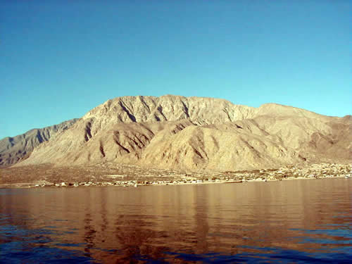
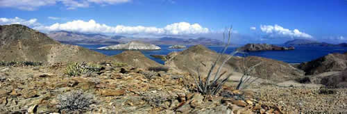
The Bay of the Angels is a ten-mile long, G-shaped bay with a spray of small islands in the opening and Puerto Don Juan on the cross bar. The town is in the center of the curve under a bulky mountainside, and it spreads north and south along the coastal slope. Much of the sprawl looks from afar to be more RV camps, both transient and permanent, and the attraction is fishing grounds readily accessible for those with trailerable boats. Our focus of the day was land chores: the buying of fresh provisions, the filling of jerry jugs with diesel and gasoline, and the checking of bank balances, etc. by Internet. In all these the town surpassed our expectations. The fueling was the most unusual. For the first time our fuel did not come from the government controlled PEMEX pumps. There is no PEMEX station here! Instead the fuel is brought in by barrel and then decanted into your jerry jugs via pre-measured containers. The fuel purchased here is more expensive than the government PEMEX prices ($3 a gallon - diesel or gasoline - as opposed to $2 at the station). Not surprising considering what they have to do to bring it in. On the other hand, it is the first time in Mexico where a liter was a full liter. Funny how most pumps put 24 or 25 liters into our 22 liter jugs!!!! After chores we schlepped all over town looking for a cheeseburger reward, finally finding it right on the beach above our dinghy! Then, as the wind began to pick up again, we motored back to Don Juan to deliver two kilos of limes. Do unto others as they have done unto you�except we did all the travel both times! But the very next morning we set out again to explore the Bay of LA's own little island cluster. We anchored in the only really viable anchorage for a boat our size, Caleta La Ventana, a oval rock bowl on the north side of the island of the same name. La Ventana means "window", and there is a window rock formation on the island's southeast corner. Two other boats were already in the anchorage, so we again said thanks for our power windlass and locker full of chain as we anchored out in the deeper mouth. Don did most of the water-based exploring when he and Alan went out hunting, as it took them four or five stops throughout the cluster to find a spot with fish and visibility and without killer currents. According to the tables, the tidal range we were seeing was about seven feet. For sure the rock bowl got much smaller as the tide went down! Other friends had done some dives in this area, but while we were there the visibility was quite low.
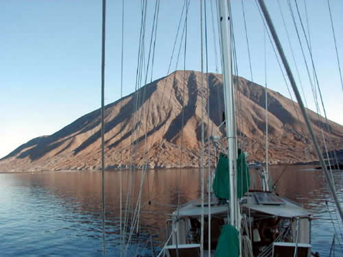
From Ventana we moved north to Isla Coronado, also known as Isla Smith, perhaps to distinguish it from Isla Coronados near Loreto. The 'coronado" in the names refers to the volcanic crown very distinctive on each. The first day we anchored T2 in a channel between Smith and the offlying Isla Mitlan, and the spot is distinctive in that we had it to ourselves. Unless you count the sea lion. At one point he was working the shoreline in one direction as Don worked the other, and I was sure they were going to collide! In the morning, the sunrise on the nearby volcano's flanks was really awesome. There was a very visible path up the mountain's side, but as it looked to be nearly vertical, we didn't even try! It was way too hot for that. The second afternoon, the wind worked itself up to 25 knots from the NW the only direction in which we were exposed, so we picked up and moved back south a mile or so to the Las Rocas Anchorage, where four of our buddies already were. Here the anchorage is slightly more protected to the NW by Isla Mitlan and two rounded rock islets. As the wind went more and more westerly, however, even this anchorage grew rocky and rolly, so we reanchored a second time, tucking ourselves as far in as we could squeeze between our friends. The rock and roll did not prevent us enjoying the communal "Noodle Hour"; we just moved the whole operation by dinghy to about ten feet off the beach. This way none of us blew off to La Paz!
|
|
home
| waypoints | logbook | reference shelf
|