Sunday. June 13, 1999 - Deep Bay, Virgin Gorda 18° 29’N; 64° 20’W We left American Yacht Harbor, St. Thomas at about 3:30 pm on Wednesday, June 9. This was about four hours after our new life raft was delivered, about two hours after the box of new TacklessII T-shirts had been collected, and about one hour after our friend Stan took the car away. It was about 24 hours after our targeted departure, but we were grateful for the excused delay provided by the late delivery of the liferaft. We'd still be there if it weren't for Stan taking over the selling of the Suzuki. In the flurry of last minute arrangements, there was no hoopla or send-off. Our friend Dave of Glory of Christiansted tossed off our lines, and we made the big journey of twenty yards to the fuel dock. From there we motored to Leinster Bay (where there were only three other boats!), and dropped the hook just as if we were on charter, made cocktails just as if we were on charter, and served up seared tuna with wasabi sauce…just as if we were on charter. This should not suggest that departure was not a big deal, just that it took several days to sink in. It should also not suggest that our friends didn't care about our leaving. We enjoyed several sendoffs: the one we threw ourselves on the dock at Independent, and the one the Tickles gang put on for us our last Friday. The first bash drew our yard and land-based friends, while the Tickles bash collected our charter colleagues. It was amazing how many could make the date, always a challenge when assembling charter crews for any activity. On Thursday we motored (still no wind) to Roadtown for a few boat errands, which we got wound up in time to motor up to Cam Bay for the night. On the way through Marina Cay, we were treated to the sight of Whisper, being used and appreciated by her new owner, his sun-bleached golden retriever (my favorite kind) and a lady friend. She looked good.
Today, the wind is back to normal, and our only casualty is the BBQ cover which blew away in the night. I did search patterns on scuba, but the squalls had us hanging first one way and then the other, so it proved a fruitless effort. Right now it looks good for departure tomorrow to Saba. The next two waves are several days out and farther south (so far), so hopefully we will feel comfortable taking a few days to stopover there before moving on to more protected waters. Don has got the water maker installation just about complete and the second bilge pump and high water alarm in place.
On the mooring at Saba (17° 38’N; 64° 46’W) the wind was gusting to 27 and howling. The anchorage at Saba is almost completely unprotected, and the shore is steep to, straight up about 3000'...sort of, and maybe three houses in sight! We got the dinghy launched after a nap, but then had outboard troubles, which in Saba could be a BIG problem. Nobody in sight...nobody in radio range...no islands to fetch up against before Central America! We made it back to the boat and then hung out for a day till we could hail a passing dive boat who passed the message to the Marine Park Manager who finally came around and gave us a tow in. My friend John Magor who owns Sea Saba, spent a day on the outboard finding about six problems beyond the initial one which was a faulty fuel line connector! We had a set of spares. Now we don't!
Tonight we sleep ashore and tomorrow we hike up Mt. Scenery, whose top is usually in the clouds. Our plan at the moment is to leave Tuesday, go to Statia (the next island south) for a few days, then to Nevis (two more south), and hope that our friends Herb and Molly from Topaz, who leave the VI for St. Martin tomorrow, will eventually catch up with us with our mail! Hope you've all had a chance to check out the last website update. (www.thetwocaptains.com ) June 26 The hike up Mt. Scenery on Saba was like a 70-minute stint on the Stairmaster. From its base in Windwardside to the top are approximately 1067 stone steps, and we’re not talking senior citizen rises either. Rob equipped us with walking sticks, but had to pass on the climb itself due to it being Monday and a work day. Sure! The lower levels of the hike were more work than reward. After the Sandy Cruz trail with its lush vegetation, the surrounds of the Mt. Scenery trail were open and scrubbly. Some of this is due to damage from Hurricane Georges last summer. Much of the tree ferns and palms seemed topped out. Also Saba has experienced a major drought this spring, so that hasn’t helped. But as we neared the top, two things happened. The ever present cloud wrapped the last couple hundred feet of the mountain in cool mists, shutting out any view, and there was a major transformation in landscape to lush tropical rain forest plants. Gone the sound of roosters crowing, and instead a pervasive chorus of frogs beneath which was a steadily growing background roar of the wind whipping over the summit. The top of Saba appears to be several small summits between which is a sort of vale that comes right out of old movies about land that time forgot. Skeletal mahogany trees, draped in hanging mosses, orchids, ferns and vines defined a canopy over ferns the size of elephants’ ears. Through it all the mists curled and the moisture dripped! We continued to the top where the radio tower perches, but there was no view and it was quite chilly!
We left Rob and Barb that afternoon, but didn’t leave Saba as expected for another day upon the recommendation of our weather forecaster as a wave was due. We spent the spare day, most of which was beautiful, on boat projects and book projects, and left the next morning bright and early. The sail from Saba to Statia was a bitch! It was only 17 miles, but the wind was south of east and so directly on our nose, and the current must have been piping because every tack seemed to curl back on itself like a banana peel. By mid afternoon we were just starting to sweat our arrival, when things steadied out, to the point that we shook out a reef and came barreling into the lee of Statia (officially St. Eustatius, but almost nowhere do you see that!) (17° 28’N; 62° 59’W). From afar you can easily see the tank farm that is Statia’s primary industry. We’ve seen them in passing in the past, but never quite realized the tanker traffic that is associated with them. As we subsequently learned, Statia is a major terminal in the oil industry. Supertankers stop and off-load crude oil. Other tankers bring in and take out various fuel and heating oils for transshipment to generating plants etc. as far away as the States. And then others stop to bunker diesel for their passages out of the Caribbean! One of these tankers appeared to be maneuvering, and since no one responded to our radio calls, we were forced to take in sail and motor around behind them just to be safe. As it turned out they didn’t move for 24 hours! Statia is shaped a bit like a camel’s back, with a hill system to the north and the remains of a volcano to the south. In between is a saddle-like ridge, that rises abruptly from the sea in a white bluff, and all of the town is built on the slow rise of the saddle. The “anchorage” in Statia is tucked behind a stone breakwater at the base of the bluff, and it is not very protected. A marine park has recently been established and we were glad to pick up one of their moorings, but we set a stern anchor like our neighbors to hold the bow into the southerly swell. Two of our neighbors were bareboats whose sailors turned out to be fellow Hoosiers! Upon learning this, we promptly raised out big Indiana state flag! (Thank you brother Greg!)
We left early the next morning for Nevis, two islands to the south, and had a much better trip. Although the wind was piping at 22-28 kts gusting higher, it had backed a few degrees and was more easterly, and while the seas were impressive at 6-8’, dousing the cockpit several times, they were more regular. We had two reefs in the main and our new staysail up, and left the engine on at low rpm to fight leeway. Evidently there was less current as we laid our course easily in one tack, doing the whole 30 mile trip in a mere five hours! What a change from the previous leg! If you are tracking us on a chart, you may wonder why we passed up St. Kitts (officially St. Christopher). It’s hard to explain why. It’s a looonngg island, with a high mountain at the north end whose gradually sloping flanks boast very active agriculture, a primary crop still being sugar cane (St. Kitts is the source of CSR, or Cane Spirits Rothchild, a white liquor.) The south end, a long relatively low scythe-shaped curve punctuated by isolated hills, has some interesting looking anchorages, but the only port of entry is in the dusty, allegedly dirty (we’ve not been there) capital city of Basseterre, and the seas in its direction seemed very rough and out of our way. St. kitts has also had some unsavory political machinations in the past five years, and perhaps the taint lingers in the mind. Such things, however, rarely have any connection with the everyday people. Most likely we passed it up this time looking ahead to remembered beautifies of Nevis, and our overall itch to hasten south as the early days of hurricane season tick off! Arriving at Nevis (17° 08’N; 62° 37’W) we found a whole armada of cruising boats at anchor. Two years ago there were only three or four! At least a half dozen of these are catamarans with summer campers aboard. We thought we’d let THAT behind in the Virgins. Most of the cruising boats came via St. Martin, it seems, but they are as happy as we are to lie here under Nevis’ sombrero like peak in flat waters. It is the first time we haven’t rolled all night since we left the Virgins! Off the bow is the long chocolate beach of the Four Seasons Resort with its dense line of palms trees behind, and yesterday I saw a pair of horseback riders canter along it. Our plan is to linger here a bit and do some island touring. July 2
The hotel obviously was accustomed to visiting hikers, and the great welcoming West Indian hostess, Sarah, who quite surely has never done this walk, equipped us with walking sticks, what proved to be a very loose map, and a Labrador guide, who opted out. Should have been a clue… The course started past some very lovely homes, then some stunningly basic shacks, and on up into the mountain. The track looked road-like for the first hour, though strewn with round stones. No monkeys, but Mary has an eye for insects and we saw several neon blue wasps, a black and red bicolor butterfly, and a leaf green caterpillar. Signs of the monkeys were all about with discarded fruits we never identified littered about..
About two hours out on passage, our SSB weather forecaster came out with an outlook quite different than the previous day’s, with dicey weather expected that night. We decided, and Tenacity behind us, that making it all the way to Guadeloupe might be pushing luck . Indeed after a rather pleasant start, the sky clouded up and conditions grew rougher. So we altered course for Montserrat, which lies at about the halfway point. Up until about 1989, Montserrat (16° 48’N; 62° 12’W) was the jet set jewel of the Caribbean. Many rock stars had homes and recording studios here. Since then it has had a really rough decade. In 1989 the island was battered by Hurricane Hugo. My neighbors in NYC, Larry and Jack had a condo there, and Jack’s told tales of widespread destruction after he was evacuated out. Then in 1997, after much had been rebuilt, the islands dormant volcano erupted. When we sailed South to Trinidad two years ago, we were dealing with passing to windward of the clouds of ash, and when we passed back by our trip north, we could smell the sulphur 90 miles to the west! Now in 1999, most of the island’s population has been relocated, many to England (it’s a British territory), and many to other islands. The remaining population has moved lock stock and barrel to the north end, which previously was considered remote! Larry and Jack would not recognize the bay we are anchored in, where once they told me a luxury marina might be built. Now, it has a concrete ferry/freighter dock, and new homes line the hillsides. At this end you would never know there was a volcano nearby. The hills are lush and green. But on our approach we could see a layer of yellow cloud underneath the overcast and Don could make out what probably was a rain of ash! The bad weather came through last night as scheduled (what a concept), and we have decided to sit out a day here waiting for the winds and seas to ease. This is no chore now that the clouds have dispersed for it a very beautiful spot. We won’t go ashore. Launching the dinghy in the wind would just be a pain. Instead, Don is working on a few little boat projects - resealing the skylight in the forward shower, mounting the holder for the autopilot remote control so we can lie in bed and see just how strong that last gust was, putting sail tape patches on the bimini where tie wraps from the solar panels have rotated around and begun to chafe; I’ve made my first loaf of bread of the trip and updated this log. You see it’s a mad pace aboard TII : Lots of books getting read and lots of naps being taken…a well deserved state of affairs. Our big dilemma now is which way to leave Montserrat tomorrow? Take the logical route and satisfy our curiosity to the state of Plymouth, Montserrat’s former capital, by passing down the lee side and risk getting ash on the boat or beat around the north side and pass safely to windward. Tune in and see what we do! July 8, 1999 - Deshaies, Guadeloupe
After a romping sail to Guadeloupe, we pulled into the village of Deshaies at Guadeloupe’s NW corner (16° 18’N; 61° 48’W), and were both surprised at the sense of familiarity with which we entered and anchored. As was the case two years ago, some sort of fete was going on with music and a parade through town. Either it was the same saints’ day we stumbled into then or a celebration of the American Independence Day or they just party every weekend! Two years ago, Deshaies is where we felt ourselves drawn into the community of cruisers. Here we first saw the boats Starbound, Gusteau, and Ol’ Dog, with Bob & Doris, Jim & Connie, and Earl and Maria, folks with who we socialized most of the rest of the summer.. We half expected to see them all there awaiting our arrival. This year there happened to be very few cruisers in the anchorage when we pulled in. Virgin Islanders will be interested to hear that one of them was Zulu Warrior, a boat with a distinctive profile that was one of the best known charter yachts in the VI for decades. We talked to the young English couple who now own it, and they say people recognize the boat from Maine to Trinidad! Obviously they’ve kept it busy cruising since they bought it. The anchorage began to fill steadily with cruisers over the next few days, including our new friends on Tenacity. With Kurt and Mary we enjoyed several expeditions on Guadeloupe. The first was a hike up the river that empties into the bay there. Kurt and Mary have limited water tankage and no watermaker so their feelings about the lovely shaded pools of cool freshwater were more passionate than ours! From the woods we emerged onto a picturesque road high above town and quenched our thirst with incredibly sweet mangoes fallen by the roadside. Ah, the good life! A few pigs eyed us malevolently like we were stealing their feed, which we may have been as a bit farther along we saw a pig feeding at a trough of fruit. Imagine mango-fed pork chops!
The city, of course, straddles the connecting throat area, with downtown on the Grand Terre side, so all traffic must cross the Riviere Salee over but two bridges, making for a bad traffic situation! The old city centre, anchored at the water’s edge bu the inevitable cruise ship dock, was a mixture of old Caribbean architecture and modern urban all crammed in close. Mostly we just walked the streets - Mary bought some fabric and I bought a CD of “The Best of Zouk”, music popular in the French West Indies, but the highlight of the day was definitely the “Glacier Italienne”, with a fabulous selection of flavors or “parfums”, of which you could cram up to four or five on a single cone! We made a point to catch the same bus back which flattered Jean Paul immensely. Although his French was especially difficult for me to track, Jean Paul treated us like we were on a charter tour rather than regional bus! We ended up staying in Deshaies almost a week thanks to a forecast spate of bad weather. This allowed our friends Herb and Molly of Topaz to catch up with our mail and enabled us to make the acquaintance of several other cruising boats that arrived before the weather with them. July 11 - Iles des Saintes
The Iles des Saintes (15° 52’N; 61° 35’W) were as delightful as we remembered. No, actually, there were MORE delightful. Either our perspective has changed or there is a definite upsurge in prosperity here. Lots of construction and renovation in the residential neighborhood, and certainly the islands were greener than two years ago. Funny… Kurt and Mary passed up the Saintes, preferring to get back to more high lush mountainous islands. We Virgin Islanders feel like we’ve found a home a way from home. And one with better bread! We hiked one day over to the lovely beach at Pontpierre at the eastern end of the island, and another day to a cool shaded beach the south west end behind Pointe Bois Joli. On this last trek I saw a house that could be the dream spot on a bluff called Morne Rouge looking east over town and the offshore islands. No camera with us that morning of course. We made two dives in the Saintes by dinghy, the first at the west end of Ilet a Cabrit and the second beneath Pain du Sucre, a 200’ knob that sticks out from shore. Neither came close to VI visibility, but the cast of reef denizens was surprisingly populous and different. Highlights for me were 4-5 jackknife fish, lots of spotted drums, garden eels, big cushion starfish, a scorpion fish and huge spotted morays all with thick clouds of grey chromis. At Pain Sucre I dove with a new friend Vivian, a guest on King’s Ransome (one of our newly acquired cruising gang), while Eric, its captain, and Don tried out their newly purchased spear guns, practicing on discarded orange juice cans! We spent our last night anchored in the lee of Pain Sucre off the premises of the Bois Joli Resort, making good our resolve to not to get stuck in the towns. I wish we’d had longer to linger there, especially after finding the beach on the other side. It’s hard to tell you how beautiful it was there, and the camera just can’t capture the panorama. Our only disappointment in the Saintes was the absence of the yellow Hobie motorcat that had delivered fresh croissants to the boats in the anchorage the moment you emerged topside with coffee. This crushed Don. We made up for it by discovering “petite dejeuner” ashore after our morning walks, which is comprised of tartine du pain ( a split baguette), fresh butter, two jams, fresh squeezed juice (passionfruit!) and café. My café au lait came with steamed milk in a bowl! We also had a great group dinner ashore at Les Amandiers of which the highlights around the table were fish crepe, aubergine (eggplant) fritters, veal escaloppes, and for dessert citron givre, a lemon sorbet frozen in a very large lemon! This fine evening had a shaky end when the three crews returned to the dock and found two of our three dinghies missing! As ours, the nicest of the three, remained, Don and I were doubtful that theft was at work, and not merely a case of poor retying by someone. These dinghy docks are small with one or two cleats, and a boat whose line has been tied on top of , can fail to retie properly. We’d made a point to tie in under everyone. Off we all went in our dingy in the pitch dark, with Herb cursing and schools of leaping needle fish bouncing in and off us and the dinghy! We found the other two dinghies adrift not far away (thank Goodness it wasn’t Saba!) and the night ended happily. The next day I noticed that we all started using locking cables! July 17 - Anse Mitan, Martinique
Remembering our bad moment in this spot two years ago, Don and I opted to drop out and anchor for the night at off the Anchorage Hotel in Dominica (15° 17’N; 61° 22’W). The others went on, and, as the skies cleared that afternoon, we hindsighted our decision relentlessly. Imagine then our thoughts the next morning when we woke to cloud cover and rain showers! There seemed little wind, however, so we went ahead anyway, and were rewarded with a very smooth trip, even around Scott’s Head. Indeed the skies cleared to such an azure blue that by the time we pulled into St. Pierre around lunch time, Don and I had burned parts of our anatomy that were seeing the sun for the first time on the trip! And we caught our first fish! OK, so it was only an itty bitty mackerel, but we broiled him up for lunch with a salad and were pleased as punch with ourselves. It was our first time to St. Pierre, Martinique (14° 44’N; 61° 10’W), which lines a long bay denting the Northwest coast of the island at the foot of Mt. Pelee, a 4800’ foot volcano…currently dormant. The cruising guide describes the town as settled “not far from where European settlers wiped out the last of the Carib Indians in 1658. It is said that before the last ones died, they uttered horrible curses, invoking the mountain to take its revenge.” The volcano took its time, allowing the French to build up a major community, with a population of 30,000, based on the rich plantations surrounding the area, that became the social, cultural, and commercial center of Martinique. On May 8, 1902, Mt. Pelee blew up, inundating the town with a fireball of superheated gas of equivalent energy to an atom bomb! Everyone was killed…except for one man named Cyparus, who was imprisoned for murder in a domed stone cell! The anchorage at St. Pierre is a very narrow shelf right off the long chocolate beach on which the town fronts. The shelf was barely wide enough for one or two boats to anchor between the shore and the drop -off. We arrived to find King’s Ransome and Topaz and five or six other boats spread along the waterfront. Once we found a niche for ourselves, we were a little disappointed to find that our friends had not sat around all morning awaiting our arrival but had taken off! On foot we toured the town on our own, where remains of pre-eruption buildings still stand, some awaiting restoration, some integrated into modern constructions. We ended up at the Volcano Museum. There, somewhat like Pompeii, they have an exhibit on the town pre and post volcano. We learned that the town had had some warning. Rumblings began in April, and ash clouds, lava flows and even a tidal wave hit that first week of May. Why didn’t people leave? Politics. An important election loomed, and leaders were afraid the balance would be tipped. No one wanted to take responsibility for evacuating the “Paris of the Caribbean”. We saw photos of the city before and after, with nothing - NOTHING - left standing. It was also fascinating to read about how the mountain continued to expand and contract for years before finally settling down to sleep. Currently, the top of the mountain is cloaked in rainforest and the lower flanks in extensive fields of sugar cane for the rum industry. Active eruptions like Montserrat must make the current residents a little ansty. All the volcanoes of the eastern Caribbean are linked together under the sea, so perhaps when one is venting all the other rest more easily!?! Outside the museum we ran into a herd of American cruise ship passengers consuming ice cream and beers. It was a little sobering, when we started chatting them up, to learn they’d been in St. Thomas the day before! An overnight trip! Back at the boat we found our friends returned only to learn that the adventure we thought we were missing, had been a major misadventure for them. While touring one of the rainforest waterfalls by rental car, Eric of King’s Ransome was robbed of his backpack by a couple of guys who took him by surprise. The others, lagging behind on the trail, responded to his shout and all gave chase which ended when they discovered that the rental car’s tires had been slashed. There’d been five cars in the lot when they hiked in, but theirs was the last car remaining. A neat scam that apparently had been perpetrated more than once, according to the police. The good news is the robbers got very little of intrinsic value; the bad news is that the backpack had contained Eric’s boat papers and his and Vivian’s passports. Eric was very sanguine as he recounted the tale. In part I think that was due to the nature of his cruise. A Florida physician, Eric is a long time liveaboard, who like many, had a long-time dream of going cruising. He decided to take a year off and do the cruise with his girlfriend, only to have her put her foot down at the eleventh hour and insist of being engaged. From Eric’s point of view, the cruise was to see if he wanted to be engaged! His solution is to single hand the cruise with contributing visitors joining him along the way, hence Vivian - a friend of a friend - who is a marine biologist. For him, the encounter was almost sort of an adventure. Our good friend Herb of Topaz, on the other hand, with his merchant marine/Navy background, seems truly affronted that he wasn’t in the position to serve out justice. This feeling has only been compounded by the lack of sympathy received from the rental car company, who want to charge him for the tires and the towing! So as you see, our stop in Dominica was providential. Ironic, too, as many people skip Dominica because they think it unsafe!
The big holiday left the city streets deserted, so we took an afternoon taxi tour with a friendly driver name Charles. Under his wing, we were tutored in the fundamentals of the Martinique’s diversified economy - all we can remember is #1 fishing, #2 rum, #6 tourism, #7 tobacco and #8 mahogany furniture - while being shown a sampler or Martinique residential neighborhoods, hotels, waterfalls, churches. The residents of this island have a very high standard of living compared to their Caribbean neighbors. Minimum wage here is $1500 a month! On the other hand everything is expensive! Tough on us yachties. As empty as the streets were on July 14, they were teeming the next. Quickly oppressed by the crowds and urban traffic, Don and I determined to move the boat to Anse Mitan, a yacht-oriented peninsula three miles across the bay. The decision was cemented after our lunch was interrupted when a Hatteras 42 named Pipe Dream began to drag its way through the anchorage. A newly arrived cruiser with its dinghy still on deck alerted us to the situation by the radio. Evidently we were the only ones home in the anchorage! We jumped in our dinghy ready to set fenders between Pipe Dream and its neighbor, but by the time we got aboard it was moving so fast that the boat behind it and TacklessII herself were next in jeopardy. As you might imagine, this gave us a shot of adrenalin and we set about setting his second and then third anchors to get the boat stopped and pulled clear. Since TacklessII was now dead astern, Don was loathe to leave. The owner finally came home from an island tour to find his boat about 300’ from where he’d left it and two sunburned samaritans encamped on his foredeck. We helped him pick all the anchors up and reanchor, and then we hightailed it out of there. A delightfully touristy mini-village, Anse Mitan (14° 33’N; 61° 03’W) fullfilled our needs for peace, quiet, breeze, bread, pate, wine, pizza, laundry, haircuts, cyber-services (did you know French keyboards are different that American?…Yikes!) and telephones, not to mention lovely morning walks in the company again of cows, goats, chickens and pigs instead of litter, automobiles and pot heads. In one of those wonderful moments of serendipity we even happened to be at hand for a parade of the teams participating in the Optimist one-design World Championships. The teams, all kids between 11 and 15, hailed from over 40 countries and territories, including Sweden, Finland, Croatia, Russia, Turkey, Greece, Japan, Tahiti, Brazil, New Zealand etc, etc. At the tail end (alphabetical order, you know) came teams not only from the USA, but our very own home turf, the USVI! July 20 - Rodney Bay St. Lucia
Today we are lying low. It’s the last of the Carnival holiday, and tomorrow we hope our forwarded mail will arrive. Services here in Rodney Bay have gotten very sophisticated with a much MUCH friendlier attitude than in the past. We could take care of pretty much all our needs here including email, which is why so many boats are stopping here. Right now, there are about ten or twelve boats we know or have come to know, and with the tempting restaurants, bars, and BBQs all around, the socialization factor is starting to dominate! In fact, due to their enviable track record for hurricane season, the yard is full and there are a number of St. Thomas boats in “storage” at the dock. But everything is fairly expensive, especially telephone calls at around $2 a minute. And so we close out our travelogue thus far. Tomorrow’s challenge, sending this and all our photos to our webmaster, cousin David. Don’t forget to email us or log in on the Guestbook Page. Best, Don & Gwen, The Two Captains
Other Web Sites of Interest for Fans of Paradise www.thecoverts.com/csy…………info on CSYs www.caribwx.com…………………A weather info site produced in Tortola by David Jones, the man we all depend on for our Caribbean cruising weather. www.flagshipvi.com………………A display of the yachts currently chartering through Flagship, the clearing house Whisper and Tackless II cleared through. www.islands.vi……….A
web page featuring the USVI with links to many businesses |
 Yesterday we sailed (yes, there was actually wind!) in tandem with
Glory up to Virgin Gorda around to the back side to anchor in Deep Bay. We wanted to
anchor here to take advantage of a cut in the reef to make a quicker start on our leg to
Saba. The weather report predicted a "tropical wave" and advised us to delay
passage til Monday. I called Rob and Barb, our friends in Saba, to advise them of our
timing, and Barb said, "Thank God, do you know what's coming?" WELL, barely
fifteen minutes after we anchored, the clouds rolled in, the wind started to howl, and the
rain sheeted down in torrents. We tossed and bopped around for several hours before a lull
came, at which time Dave upped his anchor and motored around to the Bitter End side. We
stuck it out, and did fine, but we felt pretty alone…until, of all things, a bareboat
motored in after dusk!
Yesterday we sailed (yes, there was actually wind!) in tandem with
Glory up to Virgin Gorda around to the back side to anchor in Deep Bay. We wanted to
anchor here to take advantage of a cut in the reef to make a quicker start on our leg to
Saba. The weather report predicted a "tropical wave" and advised us to delay
passage til Monday. I called Rob and Barb, our friends in Saba, to advise them of our
timing, and Barb said, "Thank God, do you know what's coming?" WELL, barely
fifteen minutes after we anchored, the clouds rolled in, the wind started to howl, and the
rain sheeted down in torrents. We tossed and bopped around for several hours before a lull
came, at which time Dave upped his anchor and motored around to the Bitter End side. We
stuck it out, and did fine, but we felt pretty alone…until, of all things, a bareboat
motored in after dusk! 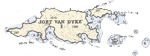 The next day we set out early to climb the Quill, the extinct
volcano. Starting at sea-level added about an hour to our climb to the crater rim at about
1800’. Most of the trail was in dry forest, and on the way up the only wild-life
noticed was hundreds of hermit crabs that threw themselves down the hill as they sensed us
coming. Near the top we passed a group of about nine Pennsylvanians on their last day of a
dive trip. Always gratifying to pass! From the rim we could look down into the steep-sided
crater which was choked with a tangle of forest, including silk cottonwood trees from
which kapok (the stuff they use to stuff lifejackets) comes. We did not attempt to descend
into the crater as we’d been advised the trail was bad. Instead we scrambled up a
path to a high point where we found a beacon and a set of nice solar panels (Hands off,
Don!) The view was impressive, but the Sahara haze kept us from seeing other islands, and
no matter how we positioned ourselves and the angle of the lens, there seemed to be no way
to capture the crater in a photo. About this time Don pronounced himself ready for a beer
and a cheeseburger! Coming down we found a much broader variety of wildlife. A white goat,
with a beard like a unicorn, came crashing down through the brush until he nearly collided
with us. Gave him quite a start! Lower, we began to see numbers of Statia’s pink
faced lizards, each about 12’ long, and the flutter and coos of morning doves in the
brush. Back on the waterfront we had that beer and cheeseburger at The Blue Bead, a nice
little waterfront spot, where we especially enjoyed an informative conversation with a
couple who work for the oil terminal.
The next day we set out early to climb the Quill, the extinct
volcano. Starting at sea-level added about an hour to our climb to the crater rim at about
1800’. Most of the trail was in dry forest, and on the way up the only wild-life
noticed was hundreds of hermit crabs that threw themselves down the hill as they sensed us
coming. Near the top we passed a group of about nine Pennsylvanians on their last day of a
dive trip. Always gratifying to pass! From the rim we could look down into the steep-sided
crater which was choked with a tangle of forest, including silk cottonwood trees from
which kapok (the stuff they use to stuff lifejackets) comes. We did not attempt to descend
into the crater as we’d been advised the trail was bad. Instead we scrambled up a
path to a high point where we found a beacon and a set of nice solar panels (Hands off,
Don!) The view was impressive, but the Sahara haze kept us from seeing other islands, and
no matter how we positioned ourselves and the angle of the lens, there seemed to be no way
to capture the crater in a photo. About this time Don pronounced himself ready for a beer
and a cheeseburger! Coming down we found a much broader variety of wildlife. A white goat,
with a beard like a unicorn, came crashing down through the brush until he nearly collided
with us. Gave him quite a start! Lower, we began to see numbers of Statia’s pink
faced lizards, each about 12’ long, and the flutter and coos of morning doves in the
brush. Back on the waterfront we had that beer and cheeseburger at The Blue Bead, a nice
little waterfront spot, where we especially enjoyed an informative conversation with a
couple who work for the oil terminal.  After about an hour, we gradually paid enough attention to the
clues at hand (and the info on “map”) to put together that we weren’t on
the “short nature walk” but on the hike to “The Source.” Water
conduits of varying age and decrepitude paralleled the trail with concrete “water
collectors” now and then. After another half hour, the track changed to a narrow
trail, clinging to edge of the steep incline. A sign said “Proceed at own risk”,
but the “map” tempted us forward with promises of waterfalls and “The
Source” itself in just another half an hour! Behind us was dry forest and ahead the
more interesting semi-tropical vegetation amidst the misty swirls of low clouds. Hah!
After scrambling up the next set of steep switchbacks and precipitous paths, we find that
the “Source” is dammed up, walled off, and, frankly, virtually dry! The
disappointment was dampened by the high of accomplishment, and once back down at the
plantation bar two hours later, opened by Sarah for us as she clearly never pegged us to
make it the whole way, we all felt pretty smugly content with ourselves. Still no monkeys,
though we did see several families of goats and pigs and a huge toad that did not offer a
“Bud” even though we begged.
After about an hour, we gradually paid enough attention to the
clues at hand (and the info on “map”) to put together that we weren’t on
the “short nature walk” but on the hike to “The Source.” Water
conduits of varying age and decrepitude paralleled the trail with concrete “water
collectors” now and then. After another half hour, the track changed to a narrow
trail, clinging to edge of the steep incline. A sign said “Proceed at own risk”,
but the “map” tempted us forward with promises of waterfalls and “The
Source” itself in just another half an hour! Behind us was dry forest and ahead the
more interesting semi-tropical vegetation amidst the misty swirls of low clouds. Hah!
After scrambling up the next set of steep switchbacks and precipitous paths, we find that
the “Source” is dammed up, walled off, and, frankly, virtually dry! The
disappointment was dampened by the high of accomplishment, and once back down at the
plantation bar two hours later, opened by Sarah for us as she clearly never pegged us to
make it the whole way, we all felt pretty smugly content with ourselves. Still no monkeys,
though we did see several families of goats and pigs and a huge toad that did not offer a
“Bud” even though we begged.
|
home
| waypoints | logbook | reference shelf
|